Next week’s forecast map has Michigan switching into the red zone
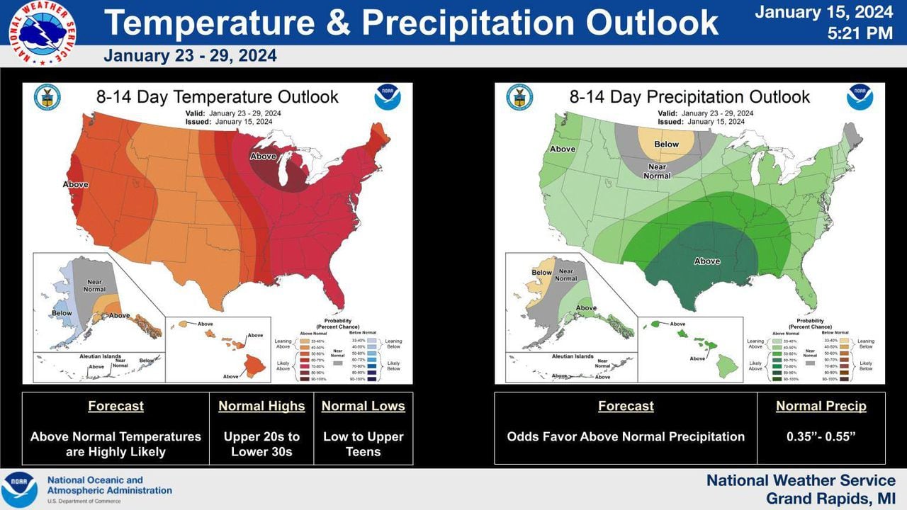
The winter weather rollercoaster in Michigan started with a warmer-than-normal start to winter, followed by a “bomb cyclone” storm that dumped snow measured in feet. This was succeeded by days of deep freeze expected to last until Saturday. The National Weather Service predicts a long-range forecast of a flip to warmer temperatures in Michigan next week, which will result in the melting of the snow. However, this could potentially lead to rises in local rivers and streams and possible flooding. For the rest of the week, an Arctic air mass has settled in the Great Lakes region leading to lake-effect snow.


Leave a Comment